

- The Medicine Bow Mountains offer premiere hiking and abundant wildlife
- Only a few hours from Rocky Mountain National Park
- Come during late May to mid-October for the best weather and access
- View the Never Summer Mountains when hiking Brown’s Lake Trail
- Spot some moose, black bears or elk
Overview
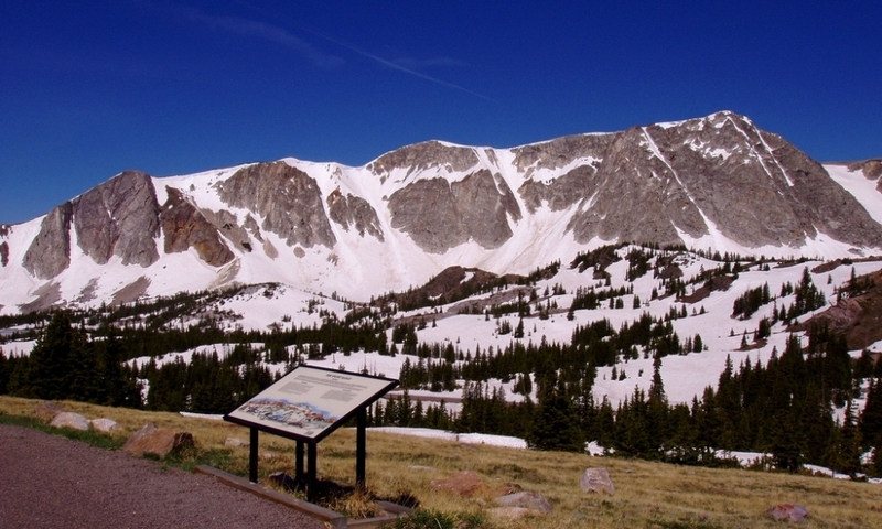
The Medicine Bow Mountains are in Colorado’s Northern Rockies and include the Colorado State Forest, the Never Summer Mountains and the Rawah Wilderness Area. They extend 100 miles and contain high peaks such as Clark Peak, rising to an elevation of 12,951 feet.
Seasons
The Medicine Bow Mountains are accessible year-round but the best time to come is late May to mid-October.
Contact
USDA Forest Service
2468 Jackson Street
Laramie, WY 82070
307-745-2300
Highlights
- Hiking
Hiking these mountains offers beautiful alpine lakes, uncrowded trails and incredible views. Blue Lake is a sparkling lake on the east side of the Rawah Range. This moderate skill level hike is about 10 miles out-and-back. For a more challenging hike, take the Blue Lake Trail to Clark Peak. You can choose short and easy roundtrip treks or go all out on an all-day excursion. If going all the way to the summit, you should start at dawn. For some amazing views of the Never Summer Mountains, take the Brown’s Lake Trail. - Wildlife Watching
There is no lack of wildlife in these mountains, with moose, black bear, elk, mountain lions and more. It’s a real pleasure spotting bobcats, lynx and coyotes in their natural environment.
Getting Here
To get to Rocky Mountain National Park from the Medicine Bow Mountains, you get on Colorado Highway 14 (Poudre Canyon Highway) heading east. You turn right on County Road 27 taking that to US Highway 34. Turn right on 34 and this will take you to Estes Park, Rocky Mountain National Park’s eastern gateway. The trip takes about 4 ½ hours.